
Fishing Destin Guide©
Who Owns the Beaches?
A local's guide to fishing around Destin and the Florida Panhandle
Who Owns the Beaches?
A local's guide to fishing around Destin and the Florida Panhandle
This web site is updated as I have time from other things going on. As there are a 1000 + different ways to do things, this is only my way of fishing, nothing else, and it is not the last word in fishing the area. I am by no means an expert but if you would like my opinion on something related to fishing the area, please email me at FishingDestinGuide@cox.net. It may take a few days before I get to it, so be patient. Thanks..... © Copyright 2014 Fishing Destin Guide All rights reserved |

Known as the "luckiest fishing village", Destin is the home to some of the best saltwater fishing in the United States. The 100 Fathom (600' depth) Curve of the Gulf of Mexico draws closer to Destin than any other spot in Florida. This, along with Destin's close proximity to the East Pass and the Gulf of Mexico, allows quick access to the Gulf of Mexico's fishing bounty. The purpose of this site is to acquaint a new fisherman to the Destin area - our local facilities, fish, waters and fishing methods. Tight lines and good fishing! |
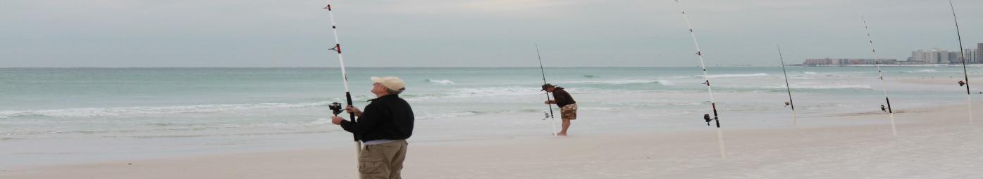
Who owns the beaches? Your rights to fish the beach |
Laws governing fishing the beaches of Destin |
| Who owns the beach? Your rights to fish . Simply stated, you have a right to fish any of the beaches in the Destin area as long as you follow the rules/laws for that beach. And the rules/laws are complicated. There are about four different sets of rules/laws to follow in the Destin area, depending on where you are fishing. The areas are: 1. All Florida beaches in general 2. Beaches within the Destin City limits 3. Beaches within the Henderson Beach State Park and Topsail State Park. Further west, the Gulf Islands National Seashore between Navarre and Pensacola. 4. Beaches on Eglin AFB First, I am not a lawyer, judge, or other public official, so this is my interpretation as a Florida citizen on what I have learned over the years. Second, It used to not be like this, but with progress comes more people. With more people comes more rules. Since we can't stop progress and go back to the "good old days", you have to know the rules. Deal with it but don't let anyone try to tell you that "you can't fish here, this is a private beach". |
Links http://www.dep.state.fl.us/lands/survey.htm http://www.law.fsu.edu/journals/landuse/Vol151/spain1.htm http://www.floridabar.org/DIVCOM/JN/JNJournal01.nsf/8c9f13012b96736985256aa900624829/83d21148206bf5ef852575bb005321eb |
Public Access Points
Surf Conditions
Beach Fishing Forums

1. YOUR RIGHTS ON FLORIDA BEACHES: In all of Florida, the beaches below the Mean High Water Line are considered public. The Florida Constitution, Article 10, Section F states: Sovereignty lands.—The title to lands under navigable waters, within the boundaries of the state, which have not been alienated, including beaches below mean high water lines, is held by the state, by virtue of its sovereignty, in trust for all the people. Sale of such lands may be authorized by law, but only when in the public interest. Private use of portions of such lands may be authorized by law, but only when not contrary to the public interest. Pretty simple to understand. In general, as long as you can get to the water and stay below (water side) the mean high water line, you have a right to be there. It is public property. Now, what is the Mean High Water Line? 2011 Florida Statutes Title XII MUNICIPALITIES Chapter 177 LAND BOUNDARIES SECTION 39 Determination of mean high-water line or mean low-water line. 177.39 Determination of mean high-water line or mean low-water line.—The location of the mean high-water line or the mean low-water line shall be determined by methods which are approved by the department for the area concerned. Geodetic bench marks shall not be used unless approved by the department. Title XII MUNICIPALITIES Chapter 177 LAND BOUNDARIES 177.38 Standards for establishment of local tidal datums.— (2) Records acquired at control tide stations, which are based on mean 19-year values, comprise the basic data from which tidal datums are determined. The Division of State Lands’ Bureau of Survey and Mapping is responsible for maintaining a repository of land records, determining the location of land and water boundaries, protecting the State’s interest in land by clearly delineating and defending the boundaries of state-owned lands and issuing opinions of title and defending the State’s title and ownership interests in property vested in the Board of Trustees of the Internal Improvement Trust Fund (Governor and Cabinet.) The Bureau of Survey and Mapping protects the boundaries of the State by: ... Assisting surveyors in determining the mean high water elevation to meet the requirements of the Coastal Mapping Act (F.S. 177 Part II) . . . dry sand beach, that part of the beach falling above the mean high water mark, calculated as an average of high tides over a number of years. The federal rule for calculating this all-important line is determined by “the average height of all waters over a period of 18.6 years.”25 The wet sand beach falling seaward of this line is governed by the public trust doctrine. 177.28 Legal significance of the mean high-water line.— (1) Mean high-water line along the shores of land immediately bordering on navigable waters is recognized and declared to be the boundary between the foreshore owned by the state in its sovereign capacity and upland subject to private ownership. However, no provision of this part shall be deemed to constitute a waiver of state ownership of sovereignty submerged lands, nor shall any provision of this part be deemed to impair the title to privately owned submerged lands validly alienated by the State of Florida or its legal predecessors. (2) No provision of this part shall be deemed to modify the common law of this state with respect to the legal effects of accretion, reliction, erosion, or avulsion. I guess you could write the Florida Bureau of Survey and Mapping and get a location for the mean high water line for a particular spot in Florida at a particular time, and it probably wouldnt change much over the years. But its kinda going overboard surveying, etc. The Destin City council at one time said the sand 25 feet landward from the water is public but it was never passed. And at one time the Sheriff of Okaloosa County, the people who would get you to move, said as long as you remained within 10-15 feet of the water, they would not bother you So, I personally try to stay within 15 feet of the water, which is plenty if you are fishing. Or, the "debris line" on the beach is a good indicator where the high water mark is (but not legal). Or, if you are really worried, stay in the "wet" sand. The mean high-tide line is a fictional line thats measured by averaging "all high-tides over and 18.6 year cycl, as determined by the Department of Commerce, NOAA, is a legal fiction because it can not be permanently drawn in the sand separating private land from public land. OK, thats the rule for most of Florida. But Destin is different. |

2. YOUR RIGHTS ON DESTIN BEACHES: In 1995, Hurricane Opal caused severe damage to several Florida beaches, resulting in their placement on the critically-eroded beaches list by the Florida Department of Environmental Protection (FDEP). To repair the damage, the City of Destin and Walton County initiated a beach renourishment program for the renourishment of 6.9 miles of beaches and dunes under the state’s Beach and Shore Preservation Act (BSPA).1 Six beachfront homeowners objected to the renourishment project, claiming that the BSPA’s process for restoring critically-eroded beaches deprives littoral property owners of their property rights without just compensation, a violation of the Fifth Amendment. The Florida Supreme Court recently rejected those claims and upheld the BSPA as constitutional. 2014 Florida Statutes Title XI COUNTY ORGANIZATION AND INTERGOVERNMENTAL RELATIONS Chapter 161 BEACH AND SHORE PRESERVATION Entire Chapter SECTION 191 Vesting of title to lands. 161.191 Vesting of title to lands.— (1) Upon the filing of a copy of the board of trustees’ resolution and the recording of the survey showing the location of the erosion control line and the area of beach to be protected as provided in s. 161.181, title to all lands seaward of the erosion control line shall be deemed to be vested in the state by right of its sovereignty, and title to all lands landward of such line shall be vested in the riparian upland owners whose lands either abut the erosion control line or would have abutted the line if it had been located directly on the line of mean high water on the date the board of trustees’ survey was recorded. (2) Once the erosion control line along any segment of the shoreline has been established in accordance with the provisions of ss. 161.141- 161.211, the common law shall no longer operate to increase or decrease the proportions of any upland property lying landward of such line, either by accretion or erosion or by any other natural or artificial process, except as provided in s. 161.211(2) and (3). However, the state shall not extend, or permit to be extended through artificial means, that portion of the protected beach lying seaward of the erosion control line beyond the limits set forth in the survey recorded by the board of trustees unless the state first obtains the written consent of all riparian upland owners whose view or access to the water’s edge would be altered or impaired. In 1961, Florida enacted the Beach and Shore Preservation Act ("BSPA") to restore and maintain critically eroded beaches within the state. In 2003, under the BSPA, the Florida Department of Environmental Protection filed for an Application for a Joint Coastal Permit and Authorization to Use Sovereign Submerged Lands in order to dredge sand from a shoal to rebuild a beach. Stop the Beach Renourishment Inc. ("SBR"), an association of homeowners, subsequently challenged the issuance of the permit and the constitutionality of the BSPA. The Florida court of appeals rescinded the permit, holding that issuance would have resulted in an unconstitutional taking. On appeal, the Supreme Court of Florida first rephrased the certified question to determine whether the BSPA was "on its face" constitutional. Then, the court held that the BSPA was not unconstitutional, reasoning that it did not deprive land owners of littoral rights without just compensation. |