View Destin GPS - Federal Waters: WEST 30-50sm in a larger map
View Destin GPS - Federal Waters: WEST 20-30sm in a larger map
View Destin GPS - Federal Waters: WEST 9-20sm in a larger map


Shipwrecks |
NATURAL BOTTOM, LEDGES, ROCKS, ETC Click here for some video footage of some of the natural bottom in this area |
ARTIFICIAL REEFS |
Destin GPS Numbers
Federal Waters -
West of the Destin pass
Federal Waters -
West of the Destin pass
-------------------------------------------------------------------------------------------------------------------------------------------------------------------------------
Angelina N 30 07.388 W 86 36.702 201° mag / 18.0 sm 30' 135' 6/23/1999 Yes
65' tug boat aka Destin Vaughn Reef
Angelina A 30 07.388 86 36.689
Angelina B 30 07.382 86 36.690
Angelina C 30 07.397 86 36.706
Angelina D 30 07.384 86 36.712
Angelina E 30 07.390 86 36.714
Angelina F 30 07.378 86 36.692
Angelina G 30 07.403 86 36.706
------------------------------------------------------------------------------------------------------------------------------------------------------------------------------
Belize Queen N 30 08.809 W 86 40.404 213° mag / 18.1 sm 30' 112' 5/31/2001 Yes
85' steel tug boat. aka Bob Reay reef
Belize Queen A 30 08.810 86 40.401
Belize Queen B 30 08.814 86 40.397
Belize Queen C 30 08.818 8640.386
Belize Queen D 30 08.807 86 40.400
Belize Queen E 30 08.807 86 40.409
Belize Queen F 30 08.804 86 40.412
Belize Queen G 30 08.802 86 40.415
Belize Queen H 30 08.810 86 40.398
-------------------------------------------------------------------------------------------------------------------------------------------------------------------------------
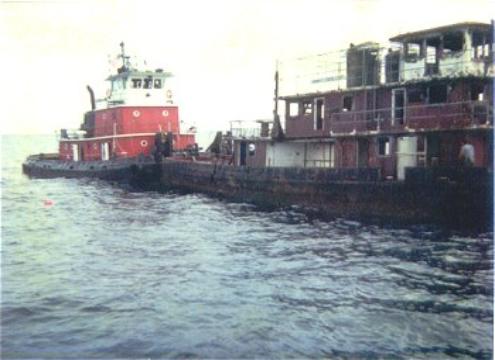
Burgess Barge 30 09.248 86 44.674 225° mag / 20.3 sm 6' 124' 6/06/1979 Yes
Steel Barge, aka 18s Reef, Old Site # 8 Barge, Diamond Barge
Burgess Barge A 30 09.258 86 44.676
Burgess Barge B 30 09.288 86 44.621
-------------------------------------------------------------------------------------------------------------------------------------------------------------------------------
Chepanoc 30 08.829 86 37.620 205° mag / 16.8 sm 28' Relief
Tugboat, 129' long, sunk December 1, 2005 in 107' of water. In the center of the Starfish Reef Complex.
Chepanoc A 30 08.823 86 37.624
Chepanoc B 30 08.826 86 37.629
Chepanoc C 30 08.833 86 37.611
Chepanoc D 30 08.831 86 37.618
Chepanoc E 30 08.823 86 37.635
Chepanoc F 30 08.830 86 37.625
Chepanoc G 30 08.842 86 37.619
Chepanoc H 30 08.839 86 37.599
-------------------------------------------------------------------------------------------------------------------------------------------------------------------------------
Deborah 30 07.512 86 35.392 197° mag / 17.50 sm 35'
132' 6/23/1999 Yes 135' tug boat aka Okaloosa Spey Reef
Deborah A 30 07.477 86 35.394
Deborah B 30 07.498 86 35.409
Deborah C 30 07.501 86 35.399
Deborah D 30 07.493 86 35.409
Deborah E 30 07.529 86 35.381
Deborah F 30 07.513 86 35.405
Deborah G 30 07.506 86 35.404
Deborah H 30 07.525 86 35.390
Deborah I 30 07.480 86 35.396
Deborah J 30 07.430 86 35.359
-------------------------------------------------------------------------------------------------------------------------------------------------------------------------------
Diamond Barge 30 09.450 86 44.620 225° mag / 20.1 sm
Unconfirmend numberfs
-------------------------------------------------------------------------------------------------------------------------------------------------------------------------------
Lost Tug MAD DOG 30 12.072 86 57.974 249° mag / 29.4 sm
Reported 105' tugboat, aka Whiteman Tug (Several wrecks are called the "Lost tug" or "Whiteman Tug").
-------------------------------------------------------------------------------------------------------------------------------------------------------------------------------
Maritimer 30 00.540 86 42.480 207° mag / 27.5sm ?' 337'
40' fishing vessel.
Maritimer 01 30 00.915 86 42.797
-------------------------------------------------------------------------------------------------------------------------------------------------------------------------------
Mohawk Chief 30 08.797 86 43.005 220° mag / 19.6 sm
93' tug boat; aka Sand Dollar complex # 7, sunk June 23, 2003 in 124'.
-------------------------------------------------------------------------------------------------------------------------------------------------------------------------------
Navarre Liberty Ship 01 30 12.765 86 49.337 241° mag / 21.4 sm
aka Joseph C Brown, in 93'/
Navarre Liberty Ship A 30 12.845 86 49.401
Navarre Liberty Ship B 30 12.838 86 49.306
Navarre Liberty Ship C 30 12.745 86 49.324
Navarre Liberty Ship D 30 12.624 86 49.328
Navarre Liberty Ship E 30 12.050 86 49.410
Navarre Liberty Ship F 30 12.782 86 49.386
-------------------------------------------------------------------------------------------------------------------------------------------------------------------------------
Navarre Barge 02 30 12.783 86 48.350 240° mag / 20.5 sm
Some sites list this also as the Navarre Liberty ship. In 89'.
Navarre Barge 02A 30 12.78 86 48.350
Navarre Barge 02B 30 12.800 86 48.319
-------------------------------------------------------------------------------------------------------------------------------------------------------------------------------
Odyssey 30 08.930 86 40.608 214° mag / 18.1 sm
75 ' steel paddle boat. aka "Sea Barb. Sunk June 26, 2002 in 111' just north west of the Belize Queen.
Odyssey A 30 08.928 86 40.588
Odyssey B 30 08.922 86 40.597
OdysseyC 30 08.931 86 40.622
Odyssey D 30 08.944 86 40.616
Odyssey E 30 08.949 86 40.641
Odyssey F 30 08.959 86 40.640
------------------------------------------------------------------------------------------------------------------------------------------------------------------------------
Oriskany 30 02.600 87 00.400 235° mag / 37.1 sm
911' long, 150' wide aircraft carrrier sunk May 17, 2006 in 212' of water.
For more information/pictures, Click Here
-------------------------------------------------------------------------------------------------------------------------------------------------------------------------------
Ozark 29 55.089 86 34.950 189° mag / 31.4sm
USS Ozark (MCs-2), 458' US Navy minelayer. Reported to have been unintentionally sunk with a Maverick missile launched from
an F-4 from Eglin AFB sunk in 330' of water. Not sure when it was sunk, have seen dates from 1979 to 1982. Divers report it sitting
almost upright with a slight list to the starboard
Ozark 01 29 55.088 86 34.928
Ozark 02 29 55.101 86 34.947
Ozark 03 29 55.107 86 34.900
Ozark 04 29 55.294 86 34.987
Ozark 05 29 55.092 86 34.951
Aground on Perdido Key after Hurricane Frederic
in 1979
-------------------------------------------------------------------------------------------------------------------------------------------------------------------------------
SW Wreck 01 30 13.115 86 42.097 229° mag / 15. 3sm
Three wood hull boats were sunk here on March 23, 1968 in 90' of water, Boats were 22', 34'. and 55' long. They were ballasted
with concrete. Probably not much left.
-------------------------------------------------------------------------------------------------------------------------------------------------------------------------------
SW Wreck 04 30 04.660 86 33.160 188° mag / 20.3 sm
Unknown wreck, not confirmed
-------------------------------------------------------------------------------------------------------------------------------------------------------------------------------
TIMBER HOLE BARGE 30 13.942 86 49.441 245° mag / 20.8 sm
Unconfirmed numbers of reported barge in 80'.
Timber Hole Barge A 30 13.764 86 49.315
Timber Hole Barge B 30 13.808 86 49.221
-------------------------------------------------------------------------------------------------------------------------------------------------------------------------------
Zeuss Tug 30 09.422 86 44.490 225° mag / 19.9 sm
Tugboat in 107'. sunk June 29, 1992.
Zeuss Tug A 30 09.419 86 44.482
Amberjack Rock 30 11.007 86 51.810 240° mag / 24.5 sm 2-6' 105' n/a No
Natural Reef system
Amberjack Rock A 30 11.008 86 51.760
Amberjack Rock B 30 11.043 86 51.756
Amberjack Rock C 30 11.025 86 51.803
Amberjack Rock D 30 11.078 86 51.764
-------------------------------------------------------------------------------------------------------------------------------------------------------------------------------
3 Mile Ledge 30 04.500 86 40.560 207° mag / 22.5 sm 4' 193' n/a No
General location of natural ledges, dropoffs, etc.
-------------------------------------------------------------------------------------------------------------------------------------------------------------------------------
18s Reef 01 30 11.997 86 32.270 189° mag / 11.8 sm 2-6' 116' n/a Yes
Area of natural rocks, ledges, and hard bottom. It gets its name from the average depth of the area, 18 fathoms (108')
18s Reef 01 A 30 11.944 86 32.266
18s Reef 01 B 30 11.957 86 32.266
18s Reef 01 C 30.11.975 86 32.259 .
18s Reef 01 D 30 11.985 86 32.288
18s Reef 01 E 30 11.025 86 32.257
18s Reef 01 F 30 11.022 86 32.291
18s Reef 01 G 30 11.044 86 32.264
18s Reef 01 H 30 11.046 86 32.292
18s Reef 01 I 30 12.080 86 32.328
-------------------------------------------------------------------------------------------------------------------------------------------------------------------------------
18s Reef 02 30 12.443 86 31.773 186° mag / 11.3 sm 2-6' 95' n/a Yes Area of natural
rocks, ledges, and hard bottom .
-------------------------------------------------------------------------------------------------------------------------------------------------------------------------------
18s Reef 03 30 12.900 86 34.900 202° mag / 11.5 sm 2-6' 100' n/a Yes
Area of natural rocks, ledges, and hard bottom
-------------------------------------------------------------------------------------------------------------------------------------------------------------------------------
18s Reef 05 30 10.419 86 31.319 184° mag / 13.6 sm 2' 128' n/a Yes
Deep hole and hard bottom .
18s Reef 05A 30 09.959 86 31.744
-------------------------------------------------------------------------------------------------------------------------------------------------------------------------------
18s Reef 06 30 12.383 86 31.220 184° mag / 11.4 sm 2-4' 103' n/a Yes
Natural reef, rocks
-------------------------------------------------------------------------------------------------------------------------------------------------------------------------------
18s Reef 07 30 12.550 86 31.290 184° mag / 11.2 sm 2-4' 104' n/a No
Half Hitch Tackle #s; Natural reef, rocks
-------------------------------------------------------------------------------------------------------------------------------------------------------------------------------
18s Reef 08 30 12.433 86 31.466 185° mag / 11.3 sm 2-4' 103' n/a Yes
Natural reef, rocks
-------------------------------------------------------------------------------------------------------------------------------------------------------------------------------
18s Reef 09 30 12.340 86 31.690 186° mag / 11.4 sm 2-4' 101' n/a Yes
Natural reef, rocks
-------------------------------------------------------------------------------------------------------------------------------------------------------------------------------
18s Reef 10 30 11.465 86 33.055 186° mag / 11.4 sm 2' 93' n/a Yes
Natural reef, rocks
-------------------------------------------------------------------------------------------------------------------------------------------------------------------------------
EDGE
Area where the continental shelf starts to descend rapidly from the gradual slope from the beach. Goes from 175' to 300' in less than
a mile. Many rock ledges, shelfs, etc located in this area and is the main fishing area for this area. Almost any type of fish can be
caught here.
Edge 01 30 07.694 86 49.863 230° mag / 25.2 sm 2-6' 184' n/a Yes
Edge 01 A 30 07.614 86 50.073
Edge 01 B 30 07.535 86 50.198
Edge 02 30 07.591 86 50.466 231° mag / 25.8 sm 2-6' 190' n/a Yes
Edge 02 A 30 07.608 86 50.471
Edge 02 B 30 07.507 86 50.462
Edge 03 30 07.460 86 51.080 232° mag / 26.3 sm 2-6' 192' n/a Yes
Edge 04 30 07.463 86 51'709 233° mag / 26.8 sm 2-6' 172' n/a Yes
Edge 04 A 30 07.463 86 51.743
Edge 04 B 30 07.413 86 51.718
Edge 05 30 07.424 86 52.062 233° mag / 27.1 sm 2-6' 174' n/a Yes
Edge 05A
Edge 06 30 07.373 86 52.244 233° mag / 27.3 sm 2-6' 173' n/a Yes
Edge 06A 30 07.386 86 52.270
Edge 06B 30 07.382 86 52.160
Edge 07 30 07.381 86 52.344 230° mag / 27.4 sm 2-6' 170' n/a Yes
Edge 07 A 30 07.346 86 52.386
Edge 08 30 07.299 86 52.669 234° mag / 27.7 sm 2-6' 170' n/a Yes
Edge 08 A 30 07.304 86 52.744
Edge 09 30 07.254 86 52.934 234° mag / 27.9 sm 2-6' 184' n/a Yes
Edge 10 30 07.183 86 53.211 235° mag / 28.9 sm 2-6' 188' n/a Yes
Edge 10 A 30 07.202 86 53,149
Edge 11 30 06.934 86 53.915 230° mag / 27.4 sm 2-6' 198' n/a Yes cliffs
Edge 12 30 06.206 86 55.911 230° mag / 27.4 sm 2-6' 230' n/a Yes
Edge 13 30 05.861 86 57,357 237° mag / 32.4 sm 2-6' 180' n/a Yes
Edge 14 30 04.487 86 58.005 237° mag / 33.2 sm 2-6' 184' n/a Yes
Edge 15 30 05.090 86 58.540 236° mag / 33.9 sm 2-6' 186' n/a Yes aka Old Forty
Edge 16 30 04.190 86 59.576 236° mag / 35.3 sm 2-6' 198' n/a Yes
Edge 17 30 06.321 86 53.326 233° mag / 28.9 sm x ' 309' n/a Yes
Edge 18 30 06.500 86 53.100 233° mag / 28.6 sm x ' 305' n/a Yes Rock cliffs
Edge 19 30 06.368 86 52.676 232° mag / 28.3 sm x ' 312' n/a Yes
Edge 20 30 07.212 86 53.078 234° mag / 28.0 sm x' 188' n/a Yes Ledges
Edge West 21 30 07.200 86 52.600 236° mag / 33.9 sm x ' 188' n/a Yes Ledges
Edge 22 30 07.480 86 51.372 235° mag / 28.3 sm x ' 170' n/a Yes
Edge 23 30 07.621 86 50.802 232° mag / 26.0 sm x ' 171' n/a Yes
Edge 23 A 30 07.578 86 50.736
Edge 23 B 30 07.533 86 50.916
Edge 24 30 07.043 86 53.970 235° mag / 28.9 sm x ' 170' n/a Yes
Edge 25 30 07.164 86 54.046 235° mag / 28.8 sm x ' 170' n/a Yes
Edge 26 30 07.323 86 53.449 235° mag / 28.3 sm 2-6' 169' n/a Yes
Edge 27 30 03.748 86 53.949 235° mag / 35.1 sm 2-6' 253' n/a Yes
Edge 28 30 07.272 86 52.795 234° mag / 27.8 sm x ' 171' n/a Yes
Edge 29 30 03.117 86 59.125 234° mag / 35.7 sm 2-6' 240' n/a Yes
Edge 30 30 01.829 86 59.967 233° mag / 37.3 sm 2-6' 221' n/a Yes
-------------------------------------------------------------------------------------------------------------------------------------------------------------------------------
MINGO RIDGE
Mingo Ridge 01 30 00.037 86 31.486 183° mag / 25.5sm 2-8' 186' n/a No Natural Bottom
Mingo Ridge 02 30 00.029 86 31.555 183° mag / 25.5sm 2-8' 192' n/a No Natural Bottom
Mingo Ridge 03 29 59.990 86 31.550 183° mag / 25.6sm 2-8' 188' n/a No Natural Bottom
Mingo Ridge 04 30 00.032 86 31.406 183° mag / 25.5sm 2-8' 185' n/a No Natural Bottom
Mingo Ridge 05 30 00.118 86 31.671 184° mag / 25.4sm 2-8' 198' n/a No Natural Bottom
Mingo Ridge 06 30 00.019 86 31.277 183° mag / 25.5sm 2-8' 186' n/a No Natural Bottom
Mingo Ridge 07 30 00.194 86 31.521 183° mag / 25.3sm 2-8' 196' n/a No Natural Bottom
Mingo Ridge 08 30 00.027 86 31.687 184° mag / 25.5sm 2-8' 198' n/a No Natural Bottom
Mingo Ridge 09 29 59.920 86 33.850 189° mag / 25.8sm 2-8' 210' n/a No Natural Bottom
Mingo Ridge 10 30 00.060 86 33.860 189° mag / 25.6sm 2-8' 209' n/a No Natural Bottom
Mingo Ridge 11 29 59.963 86 34.052 189° mag / 25.8sm 2-8' 220' n/a No Natural Bottom
-------------------------------------------------------------------------------------------------------------------------------------------------------------------------------
Nickey Grounds 01 30 11.112 86 49.443 237° mag / 22.5 sm 2- 6' 113' n/a Yes
Large natural reef system, 100 -118' deep
Nickey Grounds 01 A 30 11.102 86 49.485
Nickey Grounds 01 B 30 11.077 86 49.472
Nickey Grounds 01 C 30 11.152 86 49.484
Nickey Grounds 01 D 30 11.189 86 49.400
Nickey Grounds 01 E 30 11.082 86 49.570
-------------------------------------------------------------------------------------------------------------------------------------------------------------------------------
Pensacola Reef 25 30 07.409 87 01.474 243° mag / 34.9 sm 2-4' 103' n/a No
Natural reef system
Pensacola Reef 25 A 30 07.262 87 01.389
Pensacola Reef 25 B 30 07.508 87 01.631
-------------------------------------------------------------------------------------------------------------------------------------------------------------------------------
Pensacola Reef 31 30 06.863 87 02.397 243° mag / 36.0 sm 2-4' 108' n/a No
Natural reef system
-------------------------------------------------------------------------------------------------------------------------------------------------------------------------------
Rustys Ledge 30 05.370 86 51.860 229° mag / 28.5 sm 2-4' 304' n/a Yes Rock cliffs
-------------------------------------------------------------------------------------------------------------------------------------------------------------------------------
SW Edge 50 30 05.151 86 45.269 218° mag / 24.3 sm 4' 198' n/a Yes
Area of many natural ledges, dropoffs, etc.
SW Edge 51 30 04.921 86 45.115 217° mag / 24.4 sm 4' 198' n/a Yes
SW Edge 52 30 04.454 86 44.972 216° mag / 24.8 sm 4' 207' n/a Yes
SW Edge 53 30 04.870 86 43.960 215° mag / 23.8 sm 2-4' 202' n/a Yes
SW Edge 54 30 04.885 86 42.240 216° mag / 22.9 sm 2-4' 194' n/a Yes
SW Edge 55 30 02.320 86 43.130 210° mag / 25.9 sm 2-4' 259' n/a Yes
-------------------------------------------------------------------------------------------------------------------------------------------------------------------------------
TIMBERHOLES
Large area natural limestone rock reef system
Timberholes 01 30 11.171 86 51.485 240° mag / 24.0 sm 2- 6' 112' n/a No
Timber Hole 02 30 10.933 86 51.996 240° mag / 24.7 sm 2-6' 112' n/a No
Timber Hole 03 30 10.872 86 51.469 239° mag / 24.3 sm 2-6' 93' n/a No
Timber Hole 04 30 12.048 86 52.118 243° mag / 24.2 sm 2-6' 95' n/a No
Timber Hole 05 30 11.083 86 51.578 240° mag / 24.3 sm 2-6' 94' n/a No
Timber Hole 06 30 11.134 86 51.534 240° mag / 24.2 sm 2-6' 95' n/a No
Timber Hole 07 30 10.979 86 51.928 240° mag / 24.6 sm 2-6' 109' n/a No
Timber Hole 08 30 10.446 86 55.638 243° mag / 28.1 sm 2-6' 103' n/a No
Timber Hole 09 30 09.877 86 55.129 242° mag / 28.0 sm 2-6' 119' n/a No
Timber Hole 10 30 10.480 86 53.030 240° mag / 25.9 sm 2-6' 114' n/a No
Timber Hole 11 30 09.445 86 52.926 238° mag / 26.4 sm 2-6' 112' n/a No
Timber Hole 12 30 11.019 86 52.583 241° mag / 25.2 sm 2-6' 96' n/a No
Timber Hole 13 30 11.639 86 51.430 241° mag / 23.8 sm 2-6' 93' n/a No
Timber Hole 14 30 09.930 86 54.634 241° mag / 27.6 sm 2-6' 123' n/a No
Timber Hole 15 30 09.809 86 53.483 240° mag / 26.7 sm 2-6' 120' n/a No
Timber Hole 16 30 13.700 86 49.000 243° mag / 20.5 sm 2- 6' 95' n/a No
Timber Hole 17 30 11.023 86 51.903 240° mag / 24.6 sm 2-6' 106' n/a No
Timber Hole 18 30 10.000 86 55.000 242° mag / 27.8 sm 2-6' 115' n/a No
Timber Hole 19 30 11.106 86 54.518 243° mag / 26.8 sm 2-6' 97' n/a No
Timber Hole 20 30 09.300 86 50.200 234° mag / 24.3 sm 2-6' 112' n/a No
Timber Hole 21 30 08.771 86 58.388 243° mag / 31.5 sm 2-6' 110' n/a No
Timber Hole 22 30 09.489 86 57.296 243° mag / 30.1 sm 2-6' 112' n/a No
Timber Hole 23 30 09.331 86 57.266 243° mag / 30.2 sm 2-6' 122' n/a No
Timber Hole 24 30 08.477 86 58.807 242° mag / 32.0 sm 2-6' 110' n/a No
Timber Hole 25 30 10.689 86 50.912 238° mag / 24.0 sm 2-6' 110' n/a No
Timber Hole 26 30 10.481 86 55.675 243° mag / 28.1 sm 2-6' 104' n/a No
Timber Hole 27 30 10.539 86 50.538 237° mag / 23.7 sm 2-6' 107' n/a No
Timber Hole 28 30 09.289 86 57.880 243° mag / 30.7 sm 2- 6' 103' n/a No
Timber Hole 29 30 09.611 86 54.494 240° mag / 27.6 sm 2- 6' 123' n/a No
-------------------------------------------------------------------------------------------------------------------------------------------------------------------------------
Walls Ledge 30 11.517 86 39.031 215° mag / 14.7 sm 2-4' 99' n/a Yes
Area of natural rocks, ledges
Burgess Storage Tanks 30 09.297 86 44.491 224° mag / 20.1 sm 20' 110' 6/29/1992
-------------------------------------------------------------------------------------------------------------------------------------------------------------------------------
Chevron Oil Rig 30 04.244 87 02.118 238° mag / 37.4 sm 55' 138' 10/??/1993 Yes
Two large sections of oil rig
Chevron Oil Rig A 30 04.242 87 02.120
Chevron Oil RIg B 30 04.224 87 02.118
Chevron Oil Rig C 30 04.233 87 02.187
-------------------------------------------------------------------------------------------------------------------------------------------------------------------------------
Destin 2002 Reef 30 09.032 86 33.339 191° mag / 15.4 sm 2-6' 106' 6/7/2002 Yes
57 concrete pyramids
--------------------------------------------------------------------------------------------------------------------------------------------------------------------------------
USACE/Okaloosa County Research Project Site C 187° mag / 15.9 sm 8' 11/2009
Chicken Transport Devices and Metal A Frames
Site C1 N 30.08.498 W 086.32.990
Site C2 N 30.08.500 W 086.32.100
Site C3 N 30.08.494 W 086.32.206
Site C4 N 30.08.495 W 086.32.300
Site C5 N 30.08.500 W 086.32.400
Site C6 N 30.08.507 W 086.32.496
Site C7 N 30.08.980 W 086.32.200
Site C8 N 30.08.000 W 086.32.300
-------------------------------------------------------------------------------------------------------------------------------------------------------------------------------
Destin Deep Water Reef 1
Total of 54 concrete pyramids, 6' tall, sunk within a 1/4 mile area in 140'.
Destin DW Reef 1 A 30 08.387 86 49.066 231° mag / 24.1 sm 6' 140' 6/15/2000 Yes
General area of 18 concrete fish havens
Destin DW Reef 1 A 1 30 08.370 86 49.065
Destin DW Reef 1 A 2 30 08.406 86 49.133
-------------------------------------------------------------------------------------------------------------------------------------------------------------------------------
Destin DW Reef 1 B 30 08.381 86 48.968 230° mag / 24.0 sm 6' 139' 6/20/2000 Yes
General area of 18 - 6' concrete pyramids
-------------------------------------------------------------------------------------------------------------------------------------------------------------------------------
Destin DW Reef 1 C 30 08.308 86 48.959 230° mag / 24.1 sm 6' 145' 6/20/2000 Yes
General area of 18 - 6' concrete pyramids
-------------------------------------------------------------------------------------------------------------------------------------------------------------------------------
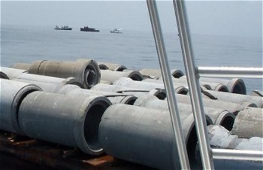
Destin DW Culvert Reef 2 30 08.796 86 40.684 214° mag / 18.3 sm 4-6'
116 culverts, 2 sizes, 6' x 8'; 2.5' x 8'm sunk in 115' of water near the Valp Culvert Reef 7 on April 2, 2001
-------------------------------------------------------------------------------------------------------------------------------------------------------------------------------
McKay Reef 30 04.000 87 04.000 240° mag / 39.1 sm 2-4' 116' ??/??/1987 No
General area of old reef consisting of appliances, shopping carts, tires
McKay Reef A 30 04.089 87 04.159
-------------------------------------------------------------------------------------------------------------------------------------------------------------------------------
Okaloosa DW Reef 29 58.402 86 313.241 183° mag / 27.4 sm
Total of 13 concrete pyramdis, 6' tall, in 244' of water. aka Okaloosa Lap Site B
-------------------------------------------------------------------------------------------------------------------------------------------------------------------------------Okaloosa
Millenium Reef 30 08.528 86 49.131 231° mag / 24.1 sm 6' 134' 6/15/2000 Yes
General area of 27 - 6' concrete pyramids
Okaloosa Millenium Reef A 30 08.516 86 49.141
Okaloosa Millenium Reef B 30 08.527 86 49.155
Okaloosa Millenium Reef C 30 08.540 86 49.133
Okaloosa Millenium Reef D 30 08.534 86 49.147
Okaloosa Millenium Reef E 30 08.519 86 49.127
Okaloosa Millenium Reef F 30 08.538 86 49.120
Okaloosa Millenium Reef G 30 08.509 86 49.129
Okaloosa Millenium Reef H 30 08.504 86 49.129
Okaloosa Millenium Reef I 30 08.519 86 49.105
-------------------------------------------------------------------------------------------------------------------------------------------------------------------------------
Pensacola Plane 24 30 06.817 87 02.736 243° mag / 36.3 sm 2-4' 103' n/a No
Reported wrecked airplane
-------------------------------------------------------------------------------------------------------------------------------------------------------------------------------
Pensacola Plane 29 30 05.529 87 04.771 242° mag / 38.8 sm ?' 102' ??/??/???? No
Reported wrecked airplane, not confirmed.
-------------------------------------------------------------------------------------------------------------------------------------------------------------------------------
Pensacola Pyramids 01 30 04.538 87 01.488 238° mag / 36.6 sm 2-4' 142' n/a No
Pensacola Pyramids 01 A 30 04.247 87 01.794
-------------------------------------------------------------------------------------------------------------------------------------------------------------------------------
SAND DOLLAR REEF COMPLEX
Mohawk Chief 30 08.797 86 43.005 220° mag / 19.6 sm 24' 124' 6/23/2003 Yes
93' tug boat; aka Sand Dollar complex # 7
Sand Dollar Reef 1 A 30 08.845 86 43.117 220° mag / 19.7 sm 6' 126' 6/11/2003 Yes
34 - 6' concrete pyramids deployed by Okaloosa County.
Sand Dollar Reef 1 B 30 08.791 86 43.195
Sand Dollar Reef 1 C 30 08.809 86 43.149
Sand Dollar Reef 1 D 30 08.767 86 43.070
Sand Dollar Reef 1 E 30 08.756 86 43.106
Sand Dollar Reef 2 A 30 08.851 86 43.130 220° mag / 19.6 sm 6' 124' 6/11/2003 Yes
34 - 6' concrete pyramids deployed by Okaloosa County.
Sand Dollar Reef 2 B 30 08.842 86 43.040
Sand Dollar Reef 2 C 30 08.872 86 43.083
Sand Dollar Reef 2 D 30 08.898 86 43.148
Sand Dollar Reef 2 E 30 08.872 86 43.092
Sand Dollar Reef 3 A 30 08.685 86 42.943 220° mag / 19.8 sm 6' 124' 6/09/2003 Yes
31 - 6' concrete pyramids deployed by City of Destin
Sand Dollar Reef 3 B 30 08.609 86 43.055
Sand Dollar Reef 3 C 30 08.639 86 43.016
Sand Dollar Reef 3 D 30 08.615 86 43.007
Sand Dollar Reef 3 E 30 08.667 86 42.996
Sand Dollar Reef 3 G 30 08.693 86 42.960
Sand Dollar Reef 4 A 30 08.678 86 42.880 219° mag / 19.8 sm 6' 124' 6/09/2003 Yes
31 - 6' concrete pyramids deployed by City of Destin
Sand Dollar Reef 4 B 30 08.763 86 42.904
Sand Dollar Reef 4 C 30 08.745 86 42.935
Sand Dollar Reef 4 D 30 08.777 86 42.988
Sand Dollar Reef 4 E 30 08.730 86 43.026
Sand Dollar Reef 5 30 08.98 86 43.010 220° mag / 19.5 sm 4-6' 124' 6/16/2003 Yes
General area of 110 concrete culverts. Deployed by City of Valparaiso.
Sand Dollar Reef 6 30 08.87 86 42.87 220° mag / 19.5 sm 4-6' 124' 6/16/2003 Yes
General area of 110 concrete culverts. Deployed by City of Valparaiso.
-------------------------------------------------------------------------------------------------------------------------------------------------------------------------------
STARFISH REEF COMPLEX: Large area reef consisting of 8 circular clusters of Florida Special 10' tall concrete pyramids (15 to a
cluster, 121 total), arranged in a one mile diameter circle around the center where the 129' tugboat Chepanoc is sunk.
Chepanoc 30 08.829 86 37.620 205° mag / 16.8 sm 28' 107' 12/1/2005 Yes
129' steel tugboat in center of Starfish Reef complex. See shipwrecks above for more information.
Starfish Reef 1 A 30 08.946 86 37.654 206 ° mag / 16.7 sm 10' 104' 6/8/2004 Yes
15 "Florida Special" concrete pyramids deployed in a 250' circle by Okaloosa county on June 8, 2004.
Starfish Reef 1 B 30 08.959 86 37.650
Starfish Reef 1 C 30 08.963 86 37.649
Starfish Reef 1 D 30 08 967 86 37.648
Starfish Reef 1 E 30 08.975 86 37.644
Starfish Reef 1 F 30 08.984 86 37.652
Starfish Reef 1 G 30 08.985 86 37.664
Starfish Reef 1 H 30 08.977 86 37.693
Starfish Reef 1 I 30 08.988 86 37.680
Starfish Reef 1 J 30 08.955 86 37.688
Starfish Reef 1 K 30 08.950 86 37.668
Starfish Reef 1 L 30 08.951 86 37.679
Starfish Reef 1 M 30 08.965 86 37.692
Starfish Reef 1 N 30 08.981 86 37.685
Starfish Reef 1 O 30 08.954 86 37.659
Starfish Reef 2 A 30 08.898 86 37.543 205° mag / 16.7 sm 10' 104' 6/8/2004 Yes
15 "Florida Special" concrete pyramids deployed in a 250' circle. Deployed by Okaloosa County.
Starfish Reef 2 B 30 08.897 86 37.520
Starfish Reef 2 C 30 08.901 86 37.504
Starfish Reef 2 D 30 08 912 86 37.504
Starfish Reef 2 E 30 08.925 86 37.498
Starfish Reef 2 F 30 08.920 86 37.505
Starfish Reef 2 G 30 08.938 86 37.514
Starfish Reef 2 H 30 08.936 86 37.526
Starfish Reef 2 I 30 08.916 86 37.552
Starfish Reef 2 J 30 08.934 86 37.505
Starfish Reef 2 K 30 08.935 86 37.539
Starfish Reef 2 L 30 08.928 86 37.550
Starfish Reef 2 M 30 08.925 86 37.546
Starfish Reef 2 N 30 08.903 86 37.543
Starfish Reef 2 O 30 08.923 86 37.526
Starfish Reef 3A 30 08.787 86 37.495 205° mag / 16.8 sm 10' 107' 6/8/2004 Yes 15 "Florida
Special" concrete pyramids deployed
Starfish Reef 3 B 30 08.774 86 37.476 in a 250'
circle. Deployed by City of Destin.
Starfish Reef 3 C 30 08 781 86 37.493
Starfish Reef 3 D 30 08.792 86 37.498
Starfish Reef 3 E 30 08.777 86 37.478
Starfish Reef 3 F 30 08.773 86 37.472
Starfish Reef 3 G 30 08.788 86 37.448
Starfish Reef 3 H 30 08.804 86.37.451
Starfish Reef 3 I 30 08.800 86 37.495
Starfish Reef 3 J 30 08.806 86 37.493
Starfish Reef 3 K 30 08.814 86 37.479
Starfish Reef 3 L 30 08.776 86 37.463
Starfish Reef 3 M 30 08.815 86 37.468
Starfish Reef 3 N 30 08.806 86 37.459
Starfish Reef 3 O 30 08.781 86 37.457
Starfish Reef 4 A 30 08.692 86 37.533 205° mag / 16.9 sm 10' 111' 6/8/2004 Yes 14 "Florida
Special" concrete pyramids deployed
Starfish Reef 4 B 30 08.656 86 37.516 in a 250'
circle. Deployed by City of Destin.
Starfish Reef 4 C 30 08 670 86 37.554
Starfish Reef 4 D 30 08.692 86 37.516
Starfish Reef 4 E 30 08.662 86 37.505
Starfish Reef 4 F 30 08.683 86 37.550
Starfish Reef 4 G 30 08.686 86 37.540
Starfish Reef 4 H 30 08.672 86.37.560
Starfish Reef 4 I 30 08.679 86 37.502
Starfish Reef 4 J 30 08.662 86 37.551
Starfish Reef 4 K 30 08.659 8637.539
Starfish Reef 4 L 30 08.649 8637.535
Starfish Reef 4 M 30 08.673 8637.503
Starfish Reef 4 N 30 08.685 8637.506
Starfish Reef 5 A 30 08.643 86 37.689 205° mag / 17.0 sm 10' 113' 4/20/2004 Yes 16 "Florida
Special" concrete pyramids deployed
Starfish Reef 5 B 30 08.653 86 37.682 in a 250'
circle. Deployed by City of Niceville.
Starfish Reef 5 C 3 008.637 86 37.700
Starfish Reef 5 D 30 08.647 86 37.706
Starfish Reef 5 E 30 08.626 86 37.644
Starfish Reef 5 F 30 08.614 86 37.655
Starfish Reef 5 G 30 08.637 86 37.657
Starfish Reef 5 H 30 08.600 86 37.683
Starfish Reef 5 I 30 08.607 86 37.678
Starfish Reef 5 J 30 08.611 86 37.692
Starfish Reef 5 K 30 08.607 86 37.698
Starfish Reef 5 L 30 08.643 86 37.674
Starfish Reef 5 M 30 08.630 86 37.680
Starfish Reef 5 N 30 08.600 86 37.669
Starfish Reef 5 O 30 08.642 86 37.647
Starfish Reef 5 P 30 08.621 86 37.691
Starfish Reef 6 A 30 08.693 86 37.815 206° mag / 17.0 sm 10' 110' 4/20/2004 Yes 15 "Florida
Special" concrete pyramids deployed
Starfish Reef 6 B 30 08.690 86 37.819 in a 250'
circle. Deployed by City of Niceville.
Starfish Reef 6 C 30 08.680 86 37.828
Starfish Reef 6 D 30 08.676 86 37.824
Starfish Reef 6 E 30 08.662 86 37.831
Starfish Reef 6 F 30 08.674 86 37.843
Starfish Reef 6 G 30 08.669 86 37.836
Starfish Reef 6 H 30 08.656 86 37.824
Starfish Reef 6 I 30 08.666 86 37.816
Starfish Reef 6 J 30 08.668 86 37.816
Starfish Reef 6 K 30 08.675 86 37.800
Starfish Reef 6 L 30 08.675 86 37.814
Starfish Reef 6 M 30 08.694 86 37.799
Starfish Reef 6 N 30 08.704 86 37.804
Starfish Reef 6 O 30 08.668 86 37.799
Starfish Reef 7 A 30 08.809 86 37.877 206° mag / 16.9 sm 10' 106' 4/20/2004 Yes 16 "Florida
Special" concrete pyramids deployed in a 250' circle. Deployed by City of Valparaiso
Starfish Reef 7 B 30 08.805 86 37.876
Starfish Reef 7 C 30 08.813 86 37.876
Starfish Reef 7 D 30 08.790 86 37.893
Starfish Reef 7 E 30 08.797 86 37.890
Starfish Reef 7 F 30 08.784 86 37.891
Starfish Reef 7 G 30 08.782 86 37.890
Starfish Reef 7 H 30 08.784 86 37.880
Starfish Reef 7 I 30 08.783 86 37.862
Starfish Reef 7 J 30 08.776 86 37.848
Starfish Reef 7 K 30 08.801 86 37.856
Starfish Reef 7 L 30 08.801 86 37.847
Starfish Reef 7 M 30 08.808 86 37.853
Starfish Reef 7 N 30 08.810 86 37.857
Starfish Reef 7 O 30 08.825 86 .37.870
Starfish Reef 7 P 30 08.795 86 37.873
Starfish Reef 8 A 30 08.940 86 37.810 206° mag / 16.8 sm 10' 105' 4/20/2004 Yes
15 "Florida Special" concrete pyramids deployed in a 250' circle. Deployed by City of Valparaiso
Starfish Reef 8 B 30 08.939 86 37.815
Starfish Reef 8 C 30 08.932 86 37.824
Starfish Reef 8 D 30 08.929 86 37.840
Starfish Reef 8 E 30 08.920 86 37.836
Starfish Reef 8 F 30.08.906 86 37.830
Starfish Reef 8 G 30.08.904 86.37.824
Starfish Reef 8 H 30.08.903 86.37.814
Starfish Reef 8 I 30.08.898 86.37.801
Starfish Reef 8 J 30.08.894 86.37.806
Starfish Reef 8 K 30.08.909 86.37.787
Starfish Reef 8 L 30.08.926 86.37.786
Starfish Reef 8 M 30.08.925 86 37.781
Starfish Reef 8 N 30.08.922 86.37.793
Starfish Reef 8 O 30 08.936 86 37.796
-------------------------------------------------------------------------------------------------------------------------------------------------------------------------------
Tank Turrets
Tank Turret 01 30 09.420 86 49.490 233° mag / 23.7 sm 2-4' 110' 5/21/1998 No
M60 Main Battle Tank turret
Tank Turret 02 30 09.420 86 49.120 233° mag / 23.4 sm 2-4' 115' 5/21/1998 No
M60 Main Battle Tank turret
Tank Turret 03 30 09.400 86 49.070 233° mag / 23.4 sm 2-4' 110' 5/21/1998 No
M60 Main Battle Tank turret
Tank Turret 04 30 09.390 86 49.000 233° mag / 23.3 sm 2-4' 115' 5/21/1998 No
M60 Main Battle Tank turret
Tank Turret 05 30 09.380 86 49.070 233° mag / 23.4 sm 2-4' 110' 5/21/1998 No
M60 Main Battle Tank turret
Tank Turret 06 30 09.420 86 48.900 233° mag / 23.2 sm 2-4' 115' 5/21/1998 No
M60 Main Battle Tank turret
Tank Turret 07 30 09.400 86 49.880 232° mag / 23.2 sm 2-4' 110' 5/21/1998 No
M60 Main Battle Tank turret
-------------------------------------------------------------------------------------------------------------------------------------------------------------------------------
Timberhole Plane 01 30 09.289 86 57.880 235° mag / 25.5 sm 4' 125' ??/??/???? No
F6F Hellcat wreck, not confirmed
-------------------------------------------------------------------------------------------------------------------------------------------------------------------------------
VALPARAISO CULVERT REEF
Valparaiso Culverts 6 A 30 08.550 86 48.975 231° mag / 23.9 sm 4' 135' 6/12/2000 Yes
General area of 30 - 4' x 7' concrete culverts
Valparaiso Culverts 6 A 1 30 08.546 86 48.949
Valparaiso Culverts 6 A 2 30 08.540 86 48.917
Valparaiso Culverts 6 A 3 30 08.540 86 49.011
Valparaiso Culverts 6 A 4 30 08.544 86 49.018
Valparaiso Culverts 6 A 5 30 08.546 86 49.051
Valparaiso Culverts 6 A 6 30 08.542 86 48.907
Valparaiso Culverts 6 B 30 08.490 86 49.046 231° mag / 24.0 sm 4' 137' 6/12/2000 Yes
General area of 30 - 4' x 7' concrete culverts
Valparaiso Culverts 6 B 1 30 08.480 86 49.047
Valparaiso Culverts 6 B 2 30 08.506 86 49.051
Valparaiso Culverts 6 B 3 30 08.456 86 49.059
Valparaiso Culverts 6 B 4 30 08.508 86 49.067
Valparaiso Culverts 6 B 5 30 08.527 86 49.030
Valparaiso Culverts 6 C 30 08.569 86 48.948 231° mag / 23.9 sm 4' 134' 6/12/2000 Yes
General area of 30 - 4' x 7' concrete culverts
-------------------------------------------------------------------------------------------------------------------------------------------------------------------------------
Valparaiso Culvert Reef 7 30 08.780 86 40.785 214° mag / 18.3 sm
109 culverts, 2 sizes, 5' x 8'; 2.5' x 8',sunk near just south of the Belize Queen in 115' of water, May 30, 2001. 4' relief.
Valparaiso Culvert Reef 7A 30 08.792 86 40.759
Valparaiso Culvert Reef 7B 30 08.792 86 40.783
Valparaiso Culvert Reef 7C 30 08.803 86 40.782
Valparaiso Culvert Reef 7D 30 08.811 86 40.762
-------------------------------------------------------------------------------------------------------------------------------------------------------------------------------
Valparaiso Culverts 8 30 08.993 86 33.269 191° mag / 15.4 sm 2-4' 106' 5/8/2002 Yes
18" culverts nested inside 30" diameter culverts Total of 94 pairs deployed
Valparaiso Culverts 8 A 30 08.991 86 33.268 .
Valparaiso Culverts 8 B 30 08.990 86 33.253
Valparaiso Culverts 8 C 30 09.016 86 33.259
Valparaiso Culverts 8 D 30 08.989 86 33.263
Valparaiso Culverts 8 E 30 08.990 86 33.277
Valparaiso Culverts 8 F 30 08.997 86 33.274
Valparaiso Culverts 8 G 30 08.993 86 33.274
Valparaiso Culverts 8 H 30 08.993 86 33.266
-------------------------------------------------------------------------------------------------------------------------------------------------------------------------------
VALPARAISO 1999 REEF
Vaparaiso 1999 Reef 1 30 08.034 86 36.300 200° mag / 17.2 sm 6' 118' 5/10/1999 No
General area of 15 - 6 ' concrete pyramids
Vaparaiso 1999 Reef 2 30 08.046 86 36.305 200° mag / 17.2 sm 6' 118' 5/10/1999 No
General area of 14 - 6 ' concrete pyramids
Vaparaiso 1999 Reef 3 30 08.047 86 36.297 200° mag / 17.2 sm 6' 118' 5/10/1999 No
General area of 11 - 6 ' concrete pyramids
Vaparaiso 1999 Reef 4 30 08.012 86 36.267 200° mag / 17.2 sm 6' 118' 5/10/1999 No
General area of 14 - 6 ' concrete pyramids
Vaparaiso 1999 Reef 5 30 08.033 86 36.275 200° mag / 17.2 sm 6' 118' 5/10/1999 No
General area of 14 - 6 ' concrete pyramids
-------------------------------------------------------------------------------------------------------------------------------------------------------------------------------
-------------------------------------------------------------------------------------------------------------------------------------------------------------------------------
Chevron Oil Rig 30 04.244 87 02.118 238° mag / 37.4 sm 55' 138' 10/??/1993 Yes
Two large sections of oil rig
Chevron Oil Rig A 30 04.242 87 02.120
Chevron Oil RIg B 30 04.224 87 02.118
Chevron Oil Rig C 30 04.233 87 02.187
-------------------------------------------------------------------------------------------------------------------------------------------------------------------------------
Destin 2002 Reef 30 09.032 86 33.339 191° mag / 15.4 sm 2-6' 106' 6/7/2002 Yes
57 concrete pyramids
--------------------------------------------------------------------------------------------------------------------------------------------------------------------------------
USACE/Okaloosa County Research Project Site C 187° mag / 15.9 sm 8' 11/2009
Chicken Transport Devices and Metal A Frames
Site C1 N 30.08.498 W 086.32.990
Site C2 N 30.08.500 W 086.32.100
Site C3 N 30.08.494 W 086.32.206
Site C4 N 30.08.495 W 086.32.300
Site C5 N 30.08.500 W 086.32.400
Site C6 N 30.08.507 W 086.32.496
Site C7 N 30.08.980 W 086.32.200
Site C8 N 30.08.000 W 086.32.300
-------------------------------------------------------------------------------------------------------------------------------------------------------------------------------
Destin Deep Water Reef 1
Total of 54 concrete pyramids, 6' tall, sunk within a 1/4 mile area in 140'.
Destin DW Reef 1 A 30 08.387 86 49.066 231° mag / 24.1 sm 6' 140' 6/15/2000 Yes
General area of 18 concrete fish havens
Destin DW Reef 1 A 1 30 08.370 86 49.065
Destin DW Reef 1 A 2 30 08.406 86 49.133
-------------------------------------------------------------------------------------------------------------------------------------------------------------------------------
Destin DW Reef 1 B 30 08.381 86 48.968 230° mag / 24.0 sm 6' 139' 6/20/2000 Yes
General area of 18 - 6' concrete pyramids
-------------------------------------------------------------------------------------------------------------------------------------------------------------------------------
Destin DW Reef 1 C 30 08.308 86 48.959 230° mag / 24.1 sm 6' 145' 6/20/2000 Yes
General area of 18 - 6' concrete pyramids
-------------------------------------------------------------------------------------------------------------------------------------------------------------------------------
Destin DW Culvert Reef 2 30 08.796 86 40.684 214° mag / 18.3 sm 4-6'
116 culverts, 2 sizes, 6' x 8'; 2.5' x 8'm sunk in 115' of water near the Valp Culvert Reef 7 on April 2, 2001
-------------------------------------------------------------------------------------------------------------------------------------------------------------------------------
McKay Reef 30 04.000 87 04.000 240° mag / 39.1 sm 2-4' 116' ??/??/1987 No
General area of old reef consisting of appliances, shopping carts, tires
McKay Reef A 30 04.089 87 04.159
-------------------------------------------------------------------------------------------------------------------------------------------------------------------------------
Okaloosa DW Reef 29 58.402 86 313.241 183° mag / 27.4 sm
Total of 13 concrete pyramdis, 6' tall, in 244' of water. aka Okaloosa Lap Site B
-------------------------------------------------------------------------------------------------------------------------------------------------------------------------------Okaloosa
Millenium Reef 30 08.528 86 49.131 231° mag / 24.1 sm 6' 134' 6/15/2000 Yes
General area of 27 - 6' concrete pyramids
Okaloosa Millenium Reef A 30 08.516 86 49.141
Okaloosa Millenium Reef B 30 08.527 86 49.155
Okaloosa Millenium Reef C 30 08.540 86 49.133
Okaloosa Millenium Reef D 30 08.534 86 49.147
Okaloosa Millenium Reef E 30 08.519 86 49.127
Okaloosa Millenium Reef F 30 08.538 86 49.120
Okaloosa Millenium Reef G 30 08.509 86 49.129
Okaloosa Millenium Reef H 30 08.504 86 49.129
Okaloosa Millenium Reef I 30 08.519 86 49.105
-------------------------------------------------------------------------------------------------------------------------------------------------------------------------------
Pensacola Plane 24 30 06.817 87 02.736 243° mag / 36.3 sm 2-4' 103' n/a No
Reported wrecked airplane
-------------------------------------------------------------------------------------------------------------------------------------------------------------------------------
Pensacola Plane 29 30 05.529 87 04.771 242° mag / 38.8 sm ?' 102' ??/??/???? No
Reported wrecked airplane, not confirmed.
-------------------------------------------------------------------------------------------------------------------------------------------------------------------------------
Pensacola Pyramids 01 30 04.538 87 01.488 238° mag / 36.6 sm 2-4' 142' n/a No
Pensacola Pyramids 01 A 30 04.247 87 01.794
-------------------------------------------------------------------------------------------------------------------------------------------------------------------------------
SAND DOLLAR REEF COMPLEX
Mohawk Chief 30 08.797 86 43.005 220° mag / 19.6 sm 24' 124' 6/23/2003 Yes
93' tug boat; aka Sand Dollar complex # 7
Sand Dollar Reef 1 A 30 08.845 86 43.117 220° mag / 19.7 sm 6' 126' 6/11/2003 Yes
34 - 6' concrete pyramids deployed by Okaloosa County.
Sand Dollar Reef 1 B 30 08.791 86 43.195
Sand Dollar Reef 1 C 30 08.809 86 43.149
Sand Dollar Reef 1 D 30 08.767 86 43.070
Sand Dollar Reef 1 E 30 08.756 86 43.106
Sand Dollar Reef 2 A 30 08.851 86 43.130 220° mag / 19.6 sm 6' 124' 6/11/2003 Yes
34 - 6' concrete pyramids deployed by Okaloosa County.
Sand Dollar Reef 2 B 30 08.842 86 43.040
Sand Dollar Reef 2 C 30 08.872 86 43.083
Sand Dollar Reef 2 D 30 08.898 86 43.148
Sand Dollar Reef 2 E 30 08.872 86 43.092
Sand Dollar Reef 3 A 30 08.685 86 42.943 220° mag / 19.8 sm 6' 124' 6/09/2003 Yes
31 - 6' concrete pyramids deployed by City of Destin
Sand Dollar Reef 3 B 30 08.609 86 43.055
Sand Dollar Reef 3 C 30 08.639 86 43.016
Sand Dollar Reef 3 D 30 08.615 86 43.007
Sand Dollar Reef 3 E 30 08.667 86 42.996
Sand Dollar Reef 3 G 30 08.693 86 42.960
Sand Dollar Reef 4 A 30 08.678 86 42.880 219° mag / 19.8 sm 6' 124' 6/09/2003 Yes
31 - 6' concrete pyramids deployed by City of Destin
Sand Dollar Reef 4 B 30 08.763 86 42.904
Sand Dollar Reef 4 C 30 08.745 86 42.935
Sand Dollar Reef 4 D 30 08.777 86 42.988
Sand Dollar Reef 4 E 30 08.730 86 43.026
Sand Dollar Reef 5 30 08.98 86 43.010 220° mag / 19.5 sm 4-6' 124' 6/16/2003 Yes
General area of 110 concrete culverts. Deployed by City of Valparaiso.
Sand Dollar Reef 6 30 08.87 86 42.87 220° mag / 19.5 sm 4-6' 124' 6/16/2003 Yes
General area of 110 concrete culverts. Deployed by City of Valparaiso.
-------------------------------------------------------------------------------------------------------------------------------------------------------------------------------
STARFISH REEF COMPLEX: Large area reef consisting of 8 circular clusters of Florida Special 10' tall concrete pyramids (15 to a
cluster, 121 total), arranged in a one mile diameter circle around the center where the 129' tugboat Chepanoc is sunk.
Chepanoc 30 08.829 86 37.620 205° mag / 16.8 sm 28' 107' 12/1/2005 Yes
129' steel tugboat in center of Starfish Reef complex. See shipwrecks above for more information.
Starfish Reef 1 A 30 08.946 86 37.654 206 ° mag / 16.7 sm 10' 104' 6/8/2004 Yes
15 "Florida Special" concrete pyramids deployed in a 250' circle by Okaloosa county on June 8, 2004.
Starfish Reef 1 B 30 08.959 86 37.650
Starfish Reef 1 C 30 08.963 86 37.649
Starfish Reef 1 D 30 08 967 86 37.648
Starfish Reef 1 E 30 08.975 86 37.644
Starfish Reef 1 F 30 08.984 86 37.652
Starfish Reef 1 G 30 08.985 86 37.664
Starfish Reef 1 H 30 08.977 86 37.693
Starfish Reef 1 I 30 08.988 86 37.680
Starfish Reef 1 J 30 08.955 86 37.688
Starfish Reef 1 K 30 08.950 86 37.668
Starfish Reef 1 L 30 08.951 86 37.679
Starfish Reef 1 M 30 08.965 86 37.692
Starfish Reef 1 N 30 08.981 86 37.685
Starfish Reef 1 O 30 08.954 86 37.659
Starfish Reef 2 A 30 08.898 86 37.543 205° mag / 16.7 sm 10' 104' 6/8/2004 Yes
15 "Florida Special" concrete pyramids deployed in a 250' circle. Deployed by Okaloosa County.
Starfish Reef 2 B 30 08.897 86 37.520
Starfish Reef 2 C 30 08.901 86 37.504
Starfish Reef 2 D 30 08 912 86 37.504
Starfish Reef 2 E 30 08.925 86 37.498
Starfish Reef 2 F 30 08.920 86 37.505
Starfish Reef 2 G 30 08.938 86 37.514
Starfish Reef 2 H 30 08.936 86 37.526
Starfish Reef 2 I 30 08.916 86 37.552
Starfish Reef 2 J 30 08.934 86 37.505
Starfish Reef 2 K 30 08.935 86 37.539
Starfish Reef 2 L 30 08.928 86 37.550
Starfish Reef 2 M 30 08.925 86 37.546
Starfish Reef 2 N 30 08.903 86 37.543
Starfish Reef 2 O 30 08.923 86 37.526
Starfish Reef 3A 30 08.787 86 37.495 205° mag / 16.8 sm 10' 107' 6/8/2004 Yes 15 "Florida
Special" concrete pyramids deployed
Starfish Reef 3 B 30 08.774 86 37.476 in a 250'
circle. Deployed by City of Destin.
Starfish Reef 3 C 30 08 781 86 37.493
Starfish Reef 3 D 30 08.792 86 37.498
Starfish Reef 3 E 30 08.777 86 37.478
Starfish Reef 3 F 30 08.773 86 37.472
Starfish Reef 3 G 30 08.788 86 37.448
Starfish Reef 3 H 30 08.804 86.37.451
Starfish Reef 3 I 30 08.800 86 37.495
Starfish Reef 3 J 30 08.806 86 37.493
Starfish Reef 3 K 30 08.814 86 37.479
Starfish Reef 3 L 30 08.776 86 37.463
Starfish Reef 3 M 30 08.815 86 37.468
Starfish Reef 3 N 30 08.806 86 37.459
Starfish Reef 3 O 30 08.781 86 37.457
Starfish Reef 4 A 30 08.692 86 37.533 205° mag / 16.9 sm 10' 111' 6/8/2004 Yes 14 "Florida
Special" concrete pyramids deployed
Starfish Reef 4 B 30 08.656 86 37.516 in a 250'
circle. Deployed by City of Destin.
Starfish Reef 4 C 30 08 670 86 37.554
Starfish Reef 4 D 30 08.692 86 37.516
Starfish Reef 4 E 30 08.662 86 37.505
Starfish Reef 4 F 30 08.683 86 37.550
Starfish Reef 4 G 30 08.686 86 37.540
Starfish Reef 4 H 30 08.672 86.37.560
Starfish Reef 4 I 30 08.679 86 37.502
Starfish Reef 4 J 30 08.662 86 37.551
Starfish Reef 4 K 30 08.659 8637.539
Starfish Reef 4 L 30 08.649 8637.535
Starfish Reef 4 M 30 08.673 8637.503
Starfish Reef 4 N 30 08.685 8637.506
Starfish Reef 5 A 30 08.643 86 37.689 205° mag / 17.0 sm 10' 113' 4/20/2004 Yes 16 "Florida
Special" concrete pyramids deployed
Starfish Reef 5 B 30 08.653 86 37.682 in a 250'
circle. Deployed by City of Niceville.
Starfish Reef 5 C 3 008.637 86 37.700
Starfish Reef 5 D 30 08.647 86 37.706
Starfish Reef 5 E 30 08.626 86 37.644
Starfish Reef 5 F 30 08.614 86 37.655
Starfish Reef 5 G 30 08.637 86 37.657
Starfish Reef 5 H 30 08.600 86 37.683
Starfish Reef 5 I 30 08.607 86 37.678
Starfish Reef 5 J 30 08.611 86 37.692
Starfish Reef 5 K 30 08.607 86 37.698
Starfish Reef 5 L 30 08.643 86 37.674
Starfish Reef 5 M 30 08.630 86 37.680
Starfish Reef 5 N 30 08.600 86 37.669
Starfish Reef 5 O 30 08.642 86 37.647
Starfish Reef 5 P 30 08.621 86 37.691
Starfish Reef 6 A 30 08.693 86 37.815 206° mag / 17.0 sm 10' 110' 4/20/2004 Yes 15 "Florida
Special" concrete pyramids deployed
Starfish Reef 6 B 30 08.690 86 37.819 in a 250'
circle. Deployed by City of Niceville.
Starfish Reef 6 C 30 08.680 86 37.828
Starfish Reef 6 D 30 08.676 86 37.824
Starfish Reef 6 E 30 08.662 86 37.831
Starfish Reef 6 F 30 08.674 86 37.843
Starfish Reef 6 G 30 08.669 86 37.836
Starfish Reef 6 H 30 08.656 86 37.824
Starfish Reef 6 I 30 08.666 86 37.816
Starfish Reef 6 J 30 08.668 86 37.816
Starfish Reef 6 K 30 08.675 86 37.800
Starfish Reef 6 L 30 08.675 86 37.814
Starfish Reef 6 M 30 08.694 86 37.799
Starfish Reef 6 N 30 08.704 86 37.804
Starfish Reef 6 O 30 08.668 86 37.799
Starfish Reef 7 A 30 08.809 86 37.877 206° mag / 16.9 sm 10' 106' 4/20/2004 Yes 16 "Florida
Special" concrete pyramids deployed in a 250' circle. Deployed by City of Valparaiso
Starfish Reef 7 B 30 08.805 86 37.876
Starfish Reef 7 C 30 08.813 86 37.876
Starfish Reef 7 D 30 08.790 86 37.893
Starfish Reef 7 E 30 08.797 86 37.890
Starfish Reef 7 F 30 08.784 86 37.891
Starfish Reef 7 G 30 08.782 86 37.890
Starfish Reef 7 H 30 08.784 86 37.880
Starfish Reef 7 I 30 08.783 86 37.862
Starfish Reef 7 J 30 08.776 86 37.848
Starfish Reef 7 K 30 08.801 86 37.856
Starfish Reef 7 L 30 08.801 86 37.847
Starfish Reef 7 M 30 08.808 86 37.853
Starfish Reef 7 N 30 08.810 86 37.857
Starfish Reef 7 O 30 08.825 86 .37.870
Starfish Reef 7 P 30 08.795 86 37.873
Starfish Reef 8 A 30 08.940 86 37.810 206° mag / 16.8 sm 10' 105' 4/20/2004 Yes
15 "Florida Special" concrete pyramids deployed in a 250' circle. Deployed by City of Valparaiso
Starfish Reef 8 B 30 08.939 86 37.815
Starfish Reef 8 C 30 08.932 86 37.824
Starfish Reef 8 D 30 08.929 86 37.840
Starfish Reef 8 E 30 08.920 86 37.836
Starfish Reef 8 F 30.08.906 86 37.830
Starfish Reef 8 G 30.08.904 86.37.824
Starfish Reef 8 H 30.08.903 86.37.814
Starfish Reef 8 I 30.08.898 86.37.801
Starfish Reef 8 J 30.08.894 86.37.806
Starfish Reef 8 K 30.08.909 86.37.787
Starfish Reef 8 L 30.08.926 86.37.786
Starfish Reef 8 M 30.08.925 86 37.781
Starfish Reef 8 N 30.08.922 86.37.793
Starfish Reef 8 O 30 08.936 86 37.796
-------------------------------------------------------------------------------------------------------------------------------------------------------------------------------
Tank Turrets
Tank Turret 01 30 09.420 86 49.490 233° mag / 23.7 sm 2-4' 110' 5/21/1998 No
M60 Main Battle Tank turret
Tank Turret 02 30 09.420 86 49.120 233° mag / 23.4 sm 2-4' 115' 5/21/1998 No
M60 Main Battle Tank turret
Tank Turret 03 30 09.400 86 49.070 233° mag / 23.4 sm 2-4' 110' 5/21/1998 No
M60 Main Battle Tank turret
Tank Turret 04 30 09.390 86 49.000 233° mag / 23.3 sm 2-4' 115' 5/21/1998 No
M60 Main Battle Tank turret
Tank Turret 05 30 09.380 86 49.070 233° mag / 23.4 sm 2-4' 110' 5/21/1998 No
M60 Main Battle Tank turret
Tank Turret 06 30 09.420 86 48.900 233° mag / 23.2 sm 2-4' 115' 5/21/1998 No
M60 Main Battle Tank turret
Tank Turret 07 30 09.400 86 49.880 232° mag / 23.2 sm 2-4' 110' 5/21/1998 No
M60 Main Battle Tank turret
-------------------------------------------------------------------------------------------------------------------------------------------------------------------------------
Timberhole Plane 01 30 09.289 86 57.880 235° mag / 25.5 sm 4' 125' ??/??/???? No
F6F Hellcat wreck, not confirmed
-------------------------------------------------------------------------------------------------------------------------------------------------------------------------------
VALPARAISO CULVERT REEF
Valparaiso Culverts 6 A 30 08.550 86 48.975 231° mag / 23.9 sm 4' 135' 6/12/2000 Yes
General area of 30 - 4' x 7' concrete culverts
Valparaiso Culverts 6 A 1 30 08.546 86 48.949
Valparaiso Culverts 6 A 2 30 08.540 86 48.917
Valparaiso Culverts 6 A 3 30 08.540 86 49.011
Valparaiso Culverts 6 A 4 30 08.544 86 49.018
Valparaiso Culverts 6 A 5 30 08.546 86 49.051
Valparaiso Culverts 6 A 6 30 08.542 86 48.907
Valparaiso Culverts 6 B 30 08.490 86 49.046 231° mag / 24.0 sm 4' 137' 6/12/2000 Yes
General area of 30 - 4' x 7' concrete culverts
Valparaiso Culverts 6 B 1 30 08.480 86 49.047
Valparaiso Culverts 6 B 2 30 08.506 86 49.051
Valparaiso Culverts 6 B 3 30 08.456 86 49.059
Valparaiso Culverts 6 B 4 30 08.508 86 49.067
Valparaiso Culverts 6 B 5 30 08.527 86 49.030
Valparaiso Culverts 6 C 30 08.569 86 48.948 231° mag / 23.9 sm 4' 134' 6/12/2000 Yes
General area of 30 - 4' x 7' concrete culverts
-------------------------------------------------------------------------------------------------------------------------------------------------------------------------------
Valparaiso Culvert Reef 7 30 08.780 86 40.785 214° mag / 18.3 sm
109 culverts, 2 sizes, 5' x 8'; 2.5' x 8',sunk near just south of the Belize Queen in 115' of water, May 30, 2001. 4' relief.
Valparaiso Culvert Reef 7A 30 08.792 86 40.759
Valparaiso Culvert Reef 7B 30 08.792 86 40.783
Valparaiso Culvert Reef 7C 30 08.803 86 40.782
Valparaiso Culvert Reef 7D 30 08.811 86 40.762
-------------------------------------------------------------------------------------------------------------------------------------------------------------------------------
Valparaiso Culverts 8 30 08.993 86 33.269 191° mag / 15.4 sm 2-4' 106' 5/8/2002 Yes
18" culverts nested inside 30" diameter culverts Total of 94 pairs deployed
Valparaiso Culverts 8 A 30 08.991 86 33.268 .
Valparaiso Culverts 8 B 30 08.990 86 33.253
Valparaiso Culverts 8 C 30 09.016 86 33.259
Valparaiso Culverts 8 D 30 08.989 86 33.263
Valparaiso Culverts 8 E 30 08.990 86 33.277
Valparaiso Culverts 8 F 30 08.997 86 33.274
Valparaiso Culverts 8 G 30 08.993 86 33.274
Valparaiso Culverts 8 H 30 08.993 86 33.266
-------------------------------------------------------------------------------------------------------------------------------------------------------------------------------
VALPARAISO 1999 REEF
Vaparaiso 1999 Reef 1 30 08.034 86 36.300 200° mag / 17.2 sm 6' 118' 5/10/1999 No
General area of 15 - 6 ' concrete pyramids
Vaparaiso 1999 Reef 2 30 08.046 86 36.305 200° mag / 17.2 sm 6' 118' 5/10/1999 No
General area of 14 - 6 ' concrete pyramids
Vaparaiso 1999 Reef 3 30 08.047 86 36.297 200° mag / 17.2 sm 6' 118' 5/10/1999 No
General area of 11 - 6 ' concrete pyramids
Vaparaiso 1999 Reef 4 30 08.012 86 36.267 200° mag / 17.2 sm 6' 118' 5/10/1999 No
General area of 14 - 6 ' concrete pyramids
Vaparaiso 1999 Reef 5 30 08.033 86 36.275 200° mag / 17.2 sm 6' 118' 5/10/1999 No
General area of 14 - 6 ' concrete pyramids
-------------------------------------------------------------------------------------------------------------------------------------------------------------------------------


| FEDERAL WATERS: 9 - 20 sm WEST OF DESTIN CB BUOY |
| FEDERAL WATERS: 20 - 30 MILES WEST OF DESTIN CB BUOY |
| FEDERAL WATERS: 30 - 50 MILES EAST OF DESTIN CB BUOY |
| For a printer friendly copy of these coordinates click here: Destin Federal Waters- WEST GPS numbers |
| Coordinates are displayed in degrees and decimal minutes. If you need to convert to another display, click on this link: Boulter LAT/LONG Converter . |


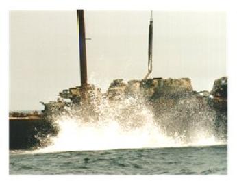


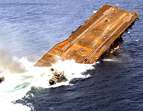
Chepanoc going under, the
centerpiece for the Starfish
Reef complex, 17 miles
southwest of Destin
centerpiece for the Starfish
Reef complex, 17 miles
southwest of Destin