View CHOCTAWHATCHEE RIVER in a larger map

Smokehouse Landing Boat Ramp 1 Herring Road FL GPS: N 30 24.654 W 86 00.193 Fee: $ 3.00, honor box to the right of ramp. Private ramp open to the public. Wide concrete boat ramp. Parking for 15+ vehicles, trash can. last visited: Aug 2010 |
| Dead River Landing Boat Ramp (aka Seven Runs) 2356 Dead River Road Red Bay, FL GPS: N 30 32.532 W 85 53.422 Fee: None Single lane, concrete boat ramp. Nice park under the trees on Dead River/Seven Runs Creek. It has 3 concrete picnic tables with grills, porta-potti, trash cans. Well marked 2.3 mile gravel road from Hwy 81 with sign on Hwy 81. Undesignated parking area for 15-20 vehicles. last visited: August 2010 |
| Seven Runs Kayak Launch Hwy 81 Red Bay, FL GPS: N 30 32.362 W 85 55.226 Fee: None NW Florida Water Management District Carry in (15') access to Seven Run's Creek Nice small park on the northwest side of the Hwy 81/Seven Runs Creek bridge. Parking lot for 8-10 cars. Covered pavilion. Four picnic tables, 3 grills, tash cans, porta-potti. last visited: August 2010 |
| Tilly Landing Boat Ramp 11267 State Hwy 81 Bruce, FL GPS: N 30 33.626 W 85 53.811 1.8 miles east of Hwy 81 along a good gravelled road. Gate half way in, but normally open. Fee: None NW Florida Water Management District managed area. Single concrete/rock boat ramp. Jon boat/bass boat accessible. Gravel parking lot for 10-12 vehicles with boat trailers, more parking available along road. Picnic pavilion with 2 tables, grill, trash can, porta potti. No water or electric. Isolated area. Camping area just north of boat ramp area. last visited: Aug 2010 |
Bozeman's Fish Camp Boat Ramp 245 BMW Road FL GPS: N 30 26.488 W 85 57.712 Fee: $ 3.00, honor box just before you go down the hill to the ramp. Private ramp open to the public Excellent, well kept single lane boat ramp. last visited: Aug 2010 |
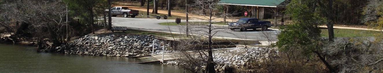
Cowford Landing New Boat Ramp Hwy 20/Choctawhatchee River bridge Ebro, FL Not shown on Google Earth but new ramp & paved parking area completed in 2010. GPS: N 30 27.043, W 85 53.945 (new ramp) Fee: Free A park/boat ramp operated by Walton County. Good, wide single lane concrete boat ramp with steel ramp at the waters edge. Designated paved parking for 11 vehicles with boat trailers, 1 handicap designated parking. Covered pavilion with picnic tables, grill. last visited: Aug 2010 |
West Bank Boat Ramps South to North to Alabama state line |
| Rooks Bluff Boat Ramp Rooks Bluff Rd FL GPS: N 30 25.735 W 85 58.933 Fee: $3.00, honor box Private fish camp/boat ramp open to the public. Single lane concrete boat ramp, steep, current can be swift at times. Parking for 10+ vehicles in open field. Unattended, sign on Black Creek Rd last visited: Aug 2010 |
Simpler Fish Camp Boat Ramp 108 McCewen St Ponce de Leon, FL 32455 (850) 835-1000 GPS: N 30 26.017 W 85 58.714 Fee: $ 3.00, honor box Private boat ramp/fish camp, open to the public. Single unimproved boat ramp. Parking for 10+ vehicles. Bait, etc available at office, unknown times of operation. |
| Cowford Landing Old Boat Ramp (aka Bruce landing, Ebro Landing) 14160 State Hwy 20 E Ebro, FL GPS: N 30 27.065, W 85 53.933 (old ramp) Walton County operated ramp. Double concrete boat ramp, still usable for small boats but use caution, concrete is broken in several pieces. New ramp has been constructed 50 yards south. Undesignated parking area for 40 + vehicles with trailers (under bridge) last visited: Aug 2010 |
Commanders Landing Boat Ramp 2309 McCaskill (River) Road Ponce de Leon, FL GPS: 30 37.193 W 85 54.616 Walton county operated boat ramp and park. Concrete boat ramp with loading dock. Park has pavilion with 4 picnic tables, 4 grills, porta-potti, trash cans, and parking in field for 15-20 vehicles. Approximately 2.3 mies from the hwy 81 turnoff on a good, well-marked gravel road. For more information, click on the link below: Commanders Landing Boat Ramp last visited: Aug 2010 |
Bruce Creek Boat Ramp aka Camp House Landing Camp House Landing Rd Ponce de Leon, Fl GPS: N 30 27.270 W 85 55.475 Walton county operated boat ramp. Single concrete boat ramp to Bruce Creek, a tributary of the Choctawhatchee River. The creek has a lot of fallen trees in it with shoaling around the ramp area. Suitable for small boats only. Parking for around 10 vehicles, trash can, fire pit. Very isolated. last visited: Aug 2010 |
Grassy Landing end of Grassy Landing Lane (dirt) GPS: N 30 38.341 W 85 54.745 Fee: None |
| Morrison Springs Boat Ramp Morrison Springs FL GPS: N 30 39.158 W 85 53.722 Fee: None Walton county operated park and boat ramp. Single lane concrete boat ramp. Newly constructed boat ramp located south of the main Morrison Springs. Boat ramp area has paved marked parking for 24 vehicles with boat trailers. Trash can, sign says "No Dogs Allowed". Open sunrise to sunset. last visited: Aug 2010 |
Cow Lake Landing Boat Ramp GPS: 30 40.517 W 85 52.762 Fee: None NWFWMD/FWC/Walton county operated ramp Single concrete boat ramp down to Cow Lake. Loose gravel at top of ramp. Parking lot is gravel, has enough room for unmarked parking for around 10 vehicles in open field. Has a picnic table, grill, trash can. Google maps does not show this ramp well but it has a cleared area around the ramp for parking and the road is clearly marked and newly gravelled. last visited: August 2010 |
Cedar Log Landing (New) Boat Ramp 28 Old Cedar Creek Rd Ponce de Leon, FL GPS: N 30 40.781 W 85 52.560 Fee: None FWC/Walton County operated park and boat ramp. Wide, steep single lane boat ramp down to the main river.Real nice park and boat ramp on a small bluff overlooking the river. Recently constructed, park has a pavilion with 2 picnic tables. Other facilities include trash cans, lights, grill, but I did not see a porta potti yet. Paved parking lot with 26 marked parking lanes for vehicles with boat trailers (1 handicap marked), 5 regular parking spots. last visited: Aug 2010 |
Coon Bottom Landing Boat Ramp aka Bonifay Hunt Club Berrian Lake Road FL GPS: N 30 41.625 W 85 51.976 Fee: None Single lane concrete boat ramp. Unmarked parking for 10-12 vehicles. Wood clubhouse to north of ramp with electric. Turn off of Hwy 181 onto dirt Coon Bottom Rd, go 0.9 miles to an intersection, turn right, go 0.4 miles to boat ramp. last visited: August 2010 |
Cedar Log Landing (Old) Boat Ramp Cedar Log Lake Rd FL GPS: N 30 40.985 W 85 52.320 Fee: None FWC operated boat ramp. Single lane concrete boat ramp on slough off Choctawhatchee River. Parking for 4-6 vehicles. Private property on both sides, do not block driveway. Google map is wrong, road ends at the boat ramp. last visited: Aug 2010 |
Berrian Lake Landing Boat Ramp (Berry Ann Landing) 1358 Berrian Lake Road FL (850) 892-8703. GPS: N 30 42.038 W 85 51.665 Fee: None Walton county operated boat ramp Wide, single lane concrete boat ramp on Berry Ann Lake off of the Choctawhatchee River. Nice park with 2 concrete picnic tables, trash cans. Unmarked parking for 10-15 vehicles. last visited: August 2010 |
Cerro Gordo Landing Boat Ramp Buck Rogers Drive Westville, Fl GPS: N 30 50.143' W 85 52.703' Fee: None NWF Water Management District ramp Unimproved dirt ramp |


Photo by J B Hillard
Known as the "luckiest fishing village", Destin is the home to some of the best saltwater fishing in the United States. The 100 Fathom (600' depth) Curve of the Gulf of Mexico draws closer to Destin than any other spot in Florida. This, along with Destin's close proximity to the East Pass and the Gulf of Mexico, allows quick access to the Gulf of Mexico's fishing bounty. The purpose of this site is to acquaint a new fisherman to the Destin area - our local facilities, fish, waters and fishing methods. Tight lines and good fishing! |
Fishing the Rivers & Creeks around Destin Choctawhatchee River Boat Ramps West Bank South to North |
Choctawhatchee River West Bank Boat Ramps |
Fishing Destin Guide©
Rivers & Creeks - Choctawhatchee River
Boat Ramps - West Bank
A local's guide to fishing around Destin and the Florida Panhandle
Rivers & Creeks - Choctawhatchee River
Boat Ramps - West Bank
A local's guide to fishing around Destin and the Florida Panhandle
Black Creek Lodge Boat Ramp 710 Black Creek Lodge Rd Freeport, FL 32439 GPS COORDINATES: N 30 26.232 W 86 06.546 CONTROLLING AUTHORITY & CONTACT INFORMATION: (850) 835-2541 Fee: $ 3.00 (believe has gone up though) Boat ramp located on private property which public is allowed to use. Located on Black Creek less than a mile from the Choctawhatchee river delta. Most popular ramp for fishing the delta. Has several areas for boat launching if various states of repair. Parking for 30+ vehicles |
Live Oak Landing Boat Ramp 229 Pitts Ave Freeport, Fl 32439 GPS COORDINATES: N 30 36.383 W 087 01.412 CONTROLLING AUTHORITY AND CONTACT INFORMATION: Live Oak Landing 877-436-5063 email: liveoaklanding@rvcoutdoors.com Website: Live Oak Landing Private boatramp for use by residents and guest at Live Oak Landing. Has cabins to rent and RV parking spots. |
This web site is updated as I have time from other things going on. As there are a 1000 + different ways to do things, this is only my way of fishing, nothing else, and it is not the last word in fishing the area. I am by no means an expert but if you would like my opinion on something related to fishing the area, please email me at FishingDestinGuide@cox.net. It may take a few days before I get to it, so be patient. Thanks..... © Copyright 2014 Fishing Destin Guide All rights reserved |
Baker Landing Boat Ramp aka Old Warehouse Landing Baker Landing Lane Westville, Fl GPS: 30 53.429 W 85 52.935 Fee: None FWC/NWFWater Management operated ramp SIngle concrete boat ramp. Very shallow at low river levels. Nice little park on the river with 3 picnic tables, grill, trash cans. Parking for 20 + vehicles in field. 1.5 miles from turnoff on Hwy 179A, well marked road. last visited: August 2010 |


